
Hurricane Arthur swept across the Outer Banks islands of North Carolina on Friday 4 July 2014, causing flooding and disruption but with no reports of loss of life or serious damage. Maps of the predicted storm serge produced by the National Hurricane Center ahead of the storm proved to be accurate, enabling evacuations to be targeted on the most vulnerable areas, while in other places home and business owners were able to move property above the level of predicted flooding. Around 44 000 homes have been left without power following the storm. The worst flooding and damage was reportedly suffered on Hatteras Island, which was subject to a mandatory evacuation, and to which residents have not yet been allowed to return.

Minor damage in Duck's Cottage Downtown Books in Manteo on Roanoke Island. Worse damage was avoided by accurate storm serge warnings, allowing stock to be raised above the level of the flood. Libby March/New York Times.
Arthur is the first Hurricane to make landfall in the United States since Hurricane Sandy in 2012. When it swept over the Outer Banks it was a Category 2 Hurricane, which implies sustained winds of 154-177 km per hour (a sustained wind implies that this wind speed is maintained for periods of a minute or longer; gusts may be much stronger), though it has since been downgraded to a Category 1 Hurricane.

The path to date and expected future path of Hurricane Arthur. Tropical Storm Risk.
Tropical storms are caused by the warming effect of the Sun over tropical seas. As the air warms it expands, causing a drop in air pressure, and rises, causing air from outside the area to rush in to replace it. If this happens over a sufficiently wide area then the inrushing winds will be affected by centrifugal forces caused by the Earth's rotation (the Coriolis effect). This means that winds will be deflected clockwise in the northern hemisphere and anti-clockwise in the southern hemisphere, eventually creating a large, rotating Tropical Storm. They have different names in different parts of the world, with those in the northwest Atlantic being referred to as hurricanes.
Despite the obvious danger of winds of this speed, which can physically blow people, and other large objects, away as well as damaging buildings and uprooting trees, the real danger from these storms comes from the flooding they bring. Each drop millibar drop in air-pressure leads to an approximate 1 cm rise in sea level, with big tropical storms capable of causing a storm serge of several meters. This is always accompanied by heavy rainfall, since warm air over the ocean leads to evaporation of sea water, which is then carried with the storm. These combined often lead to catastrophic flooding in areas hit by tropical storms.
Despite the moderate damage Hurricane Arthur is likely to have an adverse affect on the economy of the Outer Banks; the area is strongly dependent on income from tourism, and the Fourth of July holiday period is usually one of the busiest of the year, but on this occasion many people have either stayed at home or vacationed elsewhere.
See also...

Five members of of one family received minor injuries as part of a...
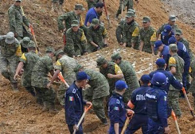
Twelve people have died when a mudslide buried a bus in Altotonga in Veracruz State, Mexico, on Monday 16 September 2013. The...

Hurricane Sandy crossed the Caribbean last week leaving at least 21...
Follow Sciency Thoughts on Facebook.